Revier3D at a glance: data, prices, limits
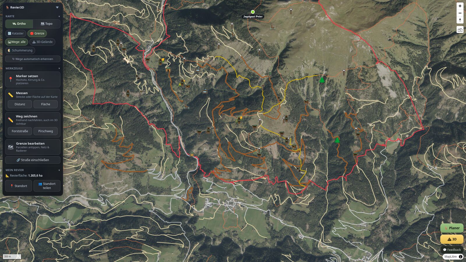
Revier3D is a hunting-ground map and ground management tool for hunters: a 2D map and 3D terrain, in the browser and as an app. Today it can be booked in Austria, and you can try it for 7 days without payment details.
Three steps to your finished ground
Who is behind Revier3D
| Product | Revier3DSoftware for the digital management of hunting grounds, on the web and as an app |
|---|---|
| Provider | Ing. Thomas Postl |
| Based in | Pernitz, Austria |
| Contact | Imprint with postal address and e-mail |
Where Revier3D can be booked today
| Bookable in | AustriaAerial image, elevation model and ground boundary from official national data |
|---|---|
| Announced | Germany, Switzerland, Czechia, Netherlands, Belgium, Francecoming soon, released one country at a time |
| Legal profile | Open seasons, reporting deadlines and official forms for all 9 Austrian federal statesLegal status 23 August 2026 (catalogue at-jagdrecht-2026.08.23-r1). Outside Austria a ground runs as a plain ground map without a legal profile. |
| Parcels from the cadastre | AustriaEntering parcel numbers is only available in Austria. A boundary file can be loaded anywhere. In countries that cannot be booked yet, this applies only once they are released. |
| Cadastre status | 1 April 2026Status of the Austrian cadastre that Revier3D uses for the parcels |
The country overview shows current availability. Details about map data and ground boundaries are on the pages for Germany and Switzerland (these three pages are in German).
What you use Revier3D on
| In the browser | On smartphone, tablet and computer, with nothing to install. One account, one ground, every device. |
|---|---|
| As a web app | Installable on the home screen: on the phone via “Add to Home Screen”, on the computer via “Install web app now” when the browser offers it. |
| As an app | Android app on Google Play. |
| All routes | All routes onto your device, on one page |
What works in a dead spot and what does not
| Entering | Always works. If the network drops, your entries are remembered and sent on their own as soon as there is reception again. Nothing is created twice. |
|---|---|
| Reading without network | After “Make available offline” in the Planner: your lists, boundary, terrain, aerial image and photos then sit on the device.The switch applies per ground and per device and needs a running subscription. |
| Loading the map | When you switch it on, the app asks once whether it should fetch the aerial image of your ground in advance. Best done at home on Wi-Fi. |
| Needs network | The finished PDF files such as the printable map, the cull record and the compliance record are created by the server. The print view in the browser works without it. |
More on the page Revierkarte offline (German) and in the help on the offline store.
What Revier3D costs
| Trial | 7 days with the Basic scope, without payment details.The only exceptions are the finished PDF files from the server. The trial ends by itself, no payment obligation arises. |
|---|---|
| Basic | 9.90 Euro per month or 99 Euro per yearStorage for photos, videos, receipts and camera pictures: 8 GB per ground |
| Pro | 39.90 Euro per month or 399 Euro per yearStorage: 50 GB per ground |
| VAT | For customers in the EU all prices include value added tax. Payment runs through Paddle. |
| After the trial | Your ground is kept and stays visible, the controls are blocked until you unlock. Nothing is lost. |
| After cancelling | The installed app with your data remains yours. Only server sync, sharing via the ground link, live weather and the trail-camera feed end with the subscription. |
Beta founder price: €9.90 a month or €99 a year. Applies to bookings made up to and including 31 December 2026. The price stays in place for as long as the subscription runs without interruption. Regular Basic price from 1 January 2027: €19.90 a month or €199 a year.
The current selection is on the home page under prices, the contract terms in the terms.
Where the map comes from
Aerial image, elevation model, cadastre and official thematic maps come from official sources. Paths, waters and buildings come from OpenStreetMap (© OpenStreetMap contributors, ODbL), the knowledge extracts about the surroundings from Wikipedia (CC BY-SA). The table lists the sources for grounds in Austria with resolution and licence:
| Role | Source | Resolution | Licence |
|---|---|---|---|
| Aerial imagery | basemap.at Orthofoto basemap.at (Verwaltungsgemeinschaft der österreichischen Länder) | 0.3 m | CC BY 4.0 |
| Terrain (DTM) | BEV Airborne Laserscan DTM 1 m Bundesamt für Eich- und Vermessungswesen (BEV) | 1 m | CC BY 4.0 |
| Surface (DSM) | BEV Airborne Laserscan DSM 1 m Bundesamt für Eich- und Vermessungswesen (BEV) | 1 m | CC BY 4.0 |
| Parcels (cadastre) | BEV digital cadastral map (DKM), parcels Federal Office of Metrology and Surveying (BEV) | Vector, as of 1 April 2026 | CC BY 4.0 |
What the official thematic maps show and what they do not is in the help on thematic maps.
What Revier3D does not do
| No verdict on a shot | The “Safety” layer shows where protected assets lie. It does not judge a shot, and an uncoloured area is not a clearance. |
|---|---|
| No legal advice | Thematic maps and hazard zones are planning information, not a live warning. The official decision, the public notice and the original official source remain binding. |
| No legal profile abroad | Open seasons, deadlines and official forms exist only for Austrian grounds. |
| OpenStreetMap is not complete | Buildings and paths come from volunteer-maintained data: what nobody has drawn there is missing here too. Lakes and ponds are not yet included among the waters. |
| No reading without preparation | Without “Make available offline” you can enter things in a dead spot, but not look them up. |
End-to-end encrypted
Your ground is end-to-end encrypted from the moment you create it in the assistant: the ground password is the key, and of markers, photos, cull record and boundary the server only sees ciphertext. What it still knows, above all the location of your 3D model, is listed as a named exception on the security page and in the whitepaper.
See for yourself
The demo runs without an account. You create your own ground in the assistant and draw the boundary before registering.